Nestled in the hilly Taconic region of the Hudson Valley and largely accessible by train, the quiet, polished ruggedness of Dutchess County is what keeps outdoor enthusiasts coming back for more. This stretch of land, known for its evolving agricultural landscape, was first inhabited by the Wappinger people early in the 17th century and eventually became one of New York’s first 12 counties imbuing the county with a rich history. With the Hudson Highlands overlooking the river to the west and the Taconic Mountain Range bordering Connecticut to the east, the county is laced with 400 miles of trails, five nationally protected areas, and over 200 parks balancing preservation of green space for year-round hiking opportunities.
Parking is free at the trailheads listed below and some are within walking distance to public transportation, so feel free to bag a few in one day, and don’t let the cold temps deter you! Though some hikes listed below are fairly steep in sections, many can be enjoyed this winter with proper footwear, snowshoes, or cross country skis. Leashed dogs are welcome on most trails, and remember to follow Leave No Trace principles.
Ferncliff Forest (Rhinebeck)| Easy | 2.6-Mile Loop
If you’re looking to climb a fire tower and don’t want too much of a hike to get there, Ferncliff Forest is the right place. The less-than-strenuous hiking makes for a great outing with the whole family or wildlife watchers, and you’ll be amongst one of the oldest-growth forests in the Hudson Valley. With over 200 acres of preserved land now maintained by the Ferncliff Forest non-profit, this trail system offers four miles of well-marked hiking with a variety of options to explore. It’s worth noting that the trails will get muddy and slippery after bouts of precipitation so check the radar and dress for the weather. Mt, Rusten trail is the most popular loop (2.6 miles) and if you’re looking for more of a workout or have more time, try linking a few trails before heading up the fire tower. The fire tower is one of the best sunset spots in the Hudson Valley. Overnight camping is allowed but you’ll have to plan ahead and contact the staff to obtain a permit. Parking is free and open year-round from dawn to dusk. 68 Mt. Rutsen Road, Rhinebeck, NY 12572
Brace Mountain (Millerton) | 3.6-Mile Round Trip | Moderate-Hard
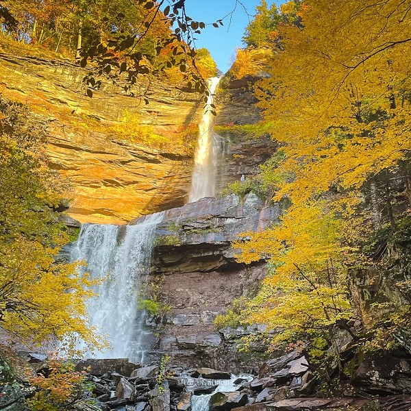
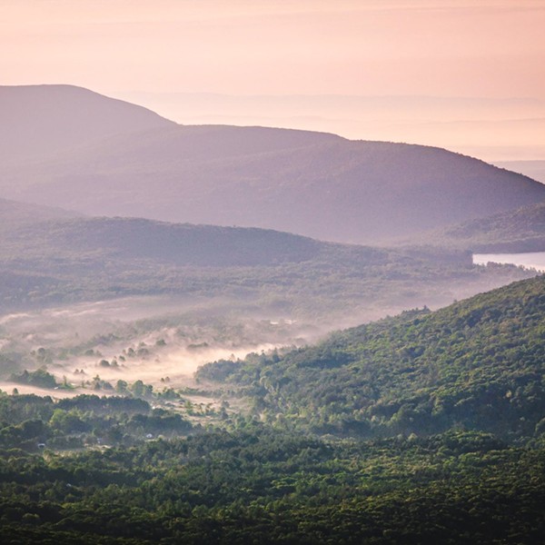
Sitting 2,311 feet above sea level, Brace Mountain boasts the highest point in Dutchess and may just be the county’s hidden gem. If you’re up for the challenge, a relatively quick yet steep hike will reward you with panoramic views of the Hudson River and Catskills, northern farmland, and the Berkshires. You’ll get most of the hoof out of the way in the first mile by way of the less-maintained Quarry Trail (marked yellow). A bit of scrambling is required here, but don’t let that challenge deter you from continuing on. About 1.4 miles in, stop for a snack break by taking a side trail to a waterfall and body of water. Sublime. Continue on to meet the white-blazed trail following the Taconic ridgeline until you reach the grassy peak marked by a cairn and windsock. If you’re lucky, you might even catch a paraglider taking off depending on the time of year. Head back the way you came and enjoy the ride home—perhaps the icing on the cake. Parking is free. 89 Quarry Hill Road, Millerton, NY 12546
Stissing Mountain Fire Tower (Pine Plains) | 2.1 Mile Loop* | Moderate-Hard
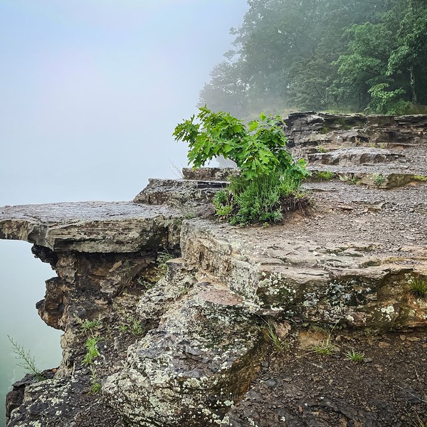
Far enough from the Hudson River, Stissing Mountain has an off-the-beaten path vibe compared to more popular hikes in Dutchess, so chances are you won’t run into many other hikers. This short and moderately strenuous hike crops up above three interconnected ponds, which served as the ancient Thompson Pond Basin and is now protected by the Nature Conservancy. Once used as a lookout point to spot fires for decades, the 80-foot fire tower here averages about 20 feet higher than other towers in the area, offering dramatic 360-degree views. A choice of two variations to the top can be accessed from two parking areas. The orange-blazed trail is short and steep and you’ll gain about 1000 feet within one mile. The blue-blazed trail will take longer, but offers a more gradual approach. Note: The top of the hike will not give you any views unless you take a deep breath and hike up that tower. You won’t regret it.
*If you’re looking for more leisure or have a set of binoculars, head over to the Thompson Pond Loop (2.7 miles). Eventually the yellow trail leads to a thin boardwalk and the pond becomes wetlands on the far end. Birders will enjoy a variety of marsh birds on view throughout the trail. Parking is free at the Thompson Pond Preserve. Note: Dogs are not allowed at the Thompson Pond Preserve. 499 Lake Road, Pine Plains, NY 12567
Nuclear Lake Loop Via Appalachian Trail (Poughquag) | Moderate | 4.3-Mile Loop
Experience what some thru-hikers deem as the prettiest part of the Appalachian Trail. Though it won’t glow in the dark, the lake sitting in the middle of this loop earned its name from a small explosion at a nearby nuclear facility in 1972 (rest assured any radioactive materials have since been cleaned up). This moderately strenuous trail is well marked and if you have time, head off of the main trail to one of the offshoots leading you to the water's edge. Enjoy a snack, spot some wildlife, and take in your surroundings. The blue blazes will lead you to the Appalachian Trail. You’ll follow a few more trails until reaching the Nuclear Lake trailhead and this will bring you around the lake. The trail is generally flat and rocky at times so watch your step. 156 Old Route 55, Pawling, NY 12564
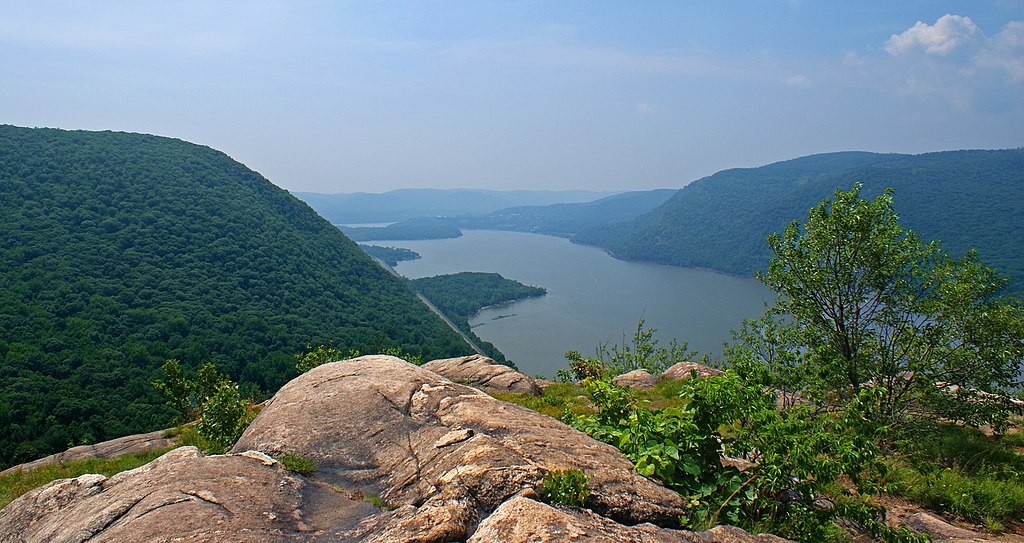
Breakneck Ridge | 3.7-Mile Loop | Difficult
Straddling the Dutchess and Putnam county lines in the Hudson Highland State Park Preserve and across the street from the train stop (weekend-only MTA stop), Breakneck Ridge is one of the most popular hikes in the Hudson Valley. Expect people along the way. It's a relatively quick and steep approach to incredible views of the Hudson River valley at the top. Head over the bridge covering Route 9D and the trail is marked white. Follow the markers directly up, and you’ll be met with serious scrambles along the way. Fallen leaves from the changing seasons plus variable weather will make this hike slippery so take extra care when hiking down. The last half-mile of the hike is completed on the road back to your car.
This trail isn’t recommended for small children and only recommended for dogs who can be carried. If you are new or inexperienced in steep scrambles as a part of hiking, there are nice alternatives in this list that share the same views. Parking is free in a small lot riverside or on the side of the road but obey the signs. 442 Breakneck Road, Beacon, NY 12508
Mount Beacon Park (Beacon) | 2.4 to 4.4-Mile Roundtrip | Moderate-Hard
Located in the city of Beacon and preserved as Mount Beacon Park thanks to Scenic Hudson, visitors can enjoy 234 acres and a well-maintained trail system that was once home to the world’s steepest funicular railway. Park at the well-marked entrance off of Route 9D. From the parking lot, begin hiking up a (literal) staircase that traces the remains of the old incline railway leading to a viewing platform. The steep hike in the beginning will be manageable by way of switchbacks. From here, continue on the red-blazed trail uphill and you’ll come to more ruins from the railway and resort which included a casino and a hotel. Take in the expansive views stretching from the Highlands across the Hudson and reaching the Catskills to the west. Turn around here or keep walking to reach the fire tower where, if you choose to reach the top, rumor has it that you can even see Manhattan on a clear day. 788 Wolcott Avenue, Beacon, NY 12508
Taconic-Hereford Perimeter Loop (Taconic) | 5.4-Mile Loop Pleasant Valley | Moderate
This perimeter loop offers a longer, peaceful hike in one of Dutchess County’s largest state parks. The single-track trail is winding with roots and rocks making for a technical yet manageable challenge for trail runners, walkers, and mountain bikers. You aren’t likely to encounter many other hikers or bikers making this hike excellent to bring a furry friend. Perhaps the length and navigation requirements of the trek give this trail a moderate rating, but you won’t find yourself challenged by the elevation gain. If this is your first time in the area, have a trail map on hand or navigation ready as the trail has few markers spread out. Note: Take care and dress appropriately if you choose to tackle this hike during hunting season. Taconic Hereford Multiple Use Area.
Tivoli Bays Trail (Tivoli) | 2-Mile Roundtrip | Easy
As one of Dutchess County’s Zen Finder Trails, minimal elevation gain along these protected tidal lowlands and wooded uplands invite visitors to get lost in thought and experience a unique perspective along the two Tivoli Bay coves on the east side of the Hudson River. Although generally a stroll in the woods, the varied terrain also hosts a wide range of activities including birding, hiking, hunting, kayaking, biking, dog walking, running, and cross-country skiing. The wetland area is home to a variety of wildlife species dependent on the habitat and, therefore, not seen on other hikes in the area. If you plan to spend time in Tivoli North Bay, come prepared with the appropriate footwear for this intertidal marshland. When the tides are low, those seeking more adventure may find exposed mudflats leading to nearby Cruger Island in the Tivoli South Cove Bay. Park for free at the Tivoli Bays Wildlife Management area: 240 Kidd Lane, Tivoli, NY 12583.