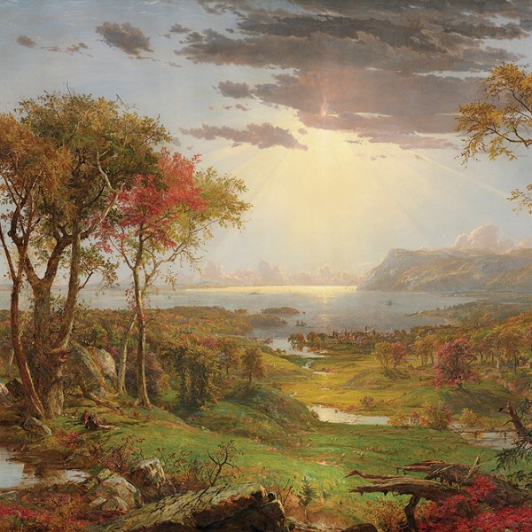
With the Catskills and Shawangunk range running through Ulster County’s 1,100 square miles, the beauty of this place is that you don’t have to be a hardcore adventurer to find your own path. Nor are you ever very far from a trail head. From tried-and-true loops to more ambitious full-day hikes out in the Catskills, there’s something here for everyone year-round. Home to 35 Catskill peaks, 350 miles of hiking trails, and seven state parks and preserves, you’ll find stunning views from ridgelines and slopes, a bit of history, worthy spots to work on your life list, and those sublime landscapes that put the Hudson River School on the map.
Here are picks for Ulster County hikes to cross off your bucket list. A note that many have parking or entrance fees. Keep in mind that you’re not paying for parking, you’re paying for the experience—pay the fee and stay a while. And don’t forget to follow Leave No Trace principles.
Sam’s Point to Verkeerderkill Falls (Cragsmoor) | Moderate | 6-Mile Out and Back or 8-Mile Loop
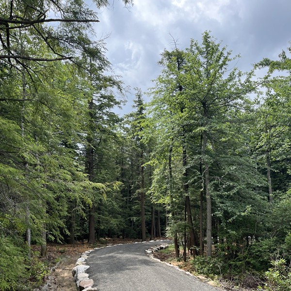
The popular Sam’s Point Area is in the southernmost area of the Minnewaska State Park. Expect a good crowd, but don’t let that deter you from enjoying the wildlife, rock formations, and views along the way on the highest section of the Shawangunk Ridge. Park at the visitor’s center and head right, up a set of switchbacks for a moderate to strenuous stroll and you’ll almost be at the famous Sam’s Point Overlook. Engage the crowds now or save it for your trip back down—either way, it’s well worth the stop. Continue on Loop Road until you see the trailhead to the most impressive waterfalls in the area dropping down 187 feet. The trail heads downhill and will take you through a rare Dwarf Pitch Pine Barren, one of the few remaining in the world. If you prefer loops, instead of retracing your stead, head on to High Point Trail and you’ll find the loop. Note: If you want to check out the ice caves in late fall, stop at the visitors center first to make sure they are open. 400 Sam’s Point Road Cragsmoor, NY 12420. Online reservation required May through October. Parking Fee: $10. Open year-round.
Overlook Mountain Trail (Woodstock) | Easy-Moderate | 4.6-Mile Round Trip
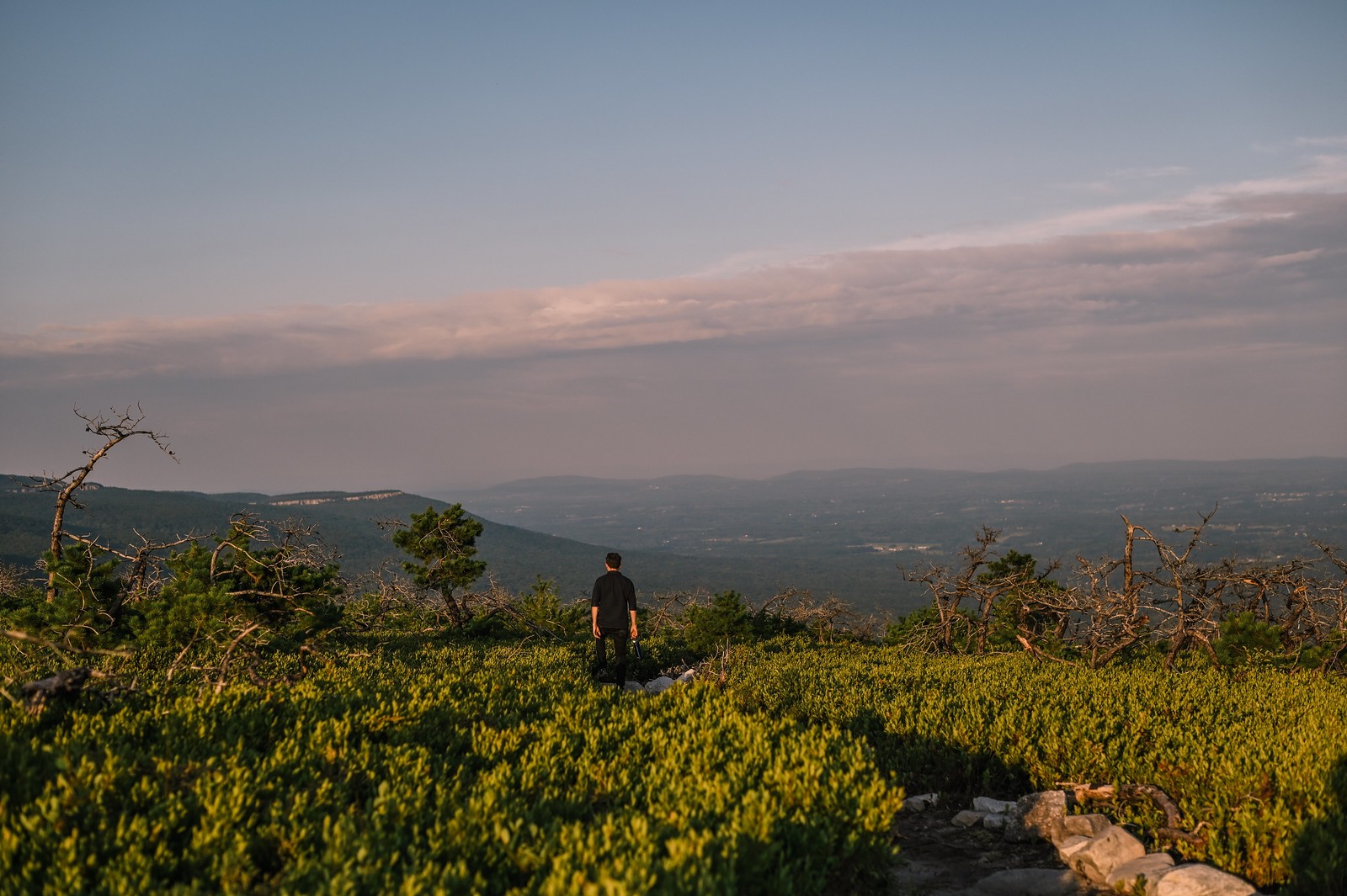
Minutes away from the town of Woodstock, the underwhelming Overlook Mountain trail (old carriage road) pays off when you reach the top. You’ll gain all your vertical while working the steep incline during the first 2.5 miles but overall, you’ll feel relaxed on this non-technical hike. The fire watchtower, built in the 1950s, will greet you at the top. Check out the Overlook Hotel Ruins and take a picnic to enjoy on one of the benches. If you get a nice day think about heading up to catch a sunrise or sunset, but don’t forget your layers this time of year. With views of the Catskills, Ashokan Reservoir, and the Hudson Valley, you will see why this spot was a favorite among the 19th-century Hudson River School artists. Hike down the way you came and if you have time, a visit to the Buddhist Monastery across the street won’t disappoint. Overlook Mountain Trailhead, 353 Meads Mountain Rd, Woodstock, NY 12498. No parking fee required.
Undivided Lot Trail (Mohonk Preserve, Gardiner) | Moderate | 5.6-Round Trip
If you’re looking to ditch the crowds, try this off-the-beaten-path trail. A moderately challenging single-track trail offers a variety of terrain and is one of the more remote areas of the Mohonk Preserve. As you start up, a hemlock forest leads to a beautiful plateau and oftentimes, ravens will join in the conversation. Follow the trail on the ridgeline. If you prefer a loop rather than out and back, make a left and go up Clove Path which has arguably the most vertical gain for distance traveled in all of Mohonk according to the locals. Loop on to Stokes trail, coming down on rock ledges that drop you to an old dam. The roundtrip option ends at Old Minnewaska Road. Turn around here. Park at Spring Farm Trailhead or the Yellow Chapel on County Route 6. 984 County Route 6, High Falls, NY 12440. Parking Fee: $15
Mount Wittenberg (Phoenicia) | Difficult | 7.5-Round-Trip
Offering one of the finest lookouts to the Catskills (at 3,784 feet of elevation), Wittenberg is well worth the effort and a great challenge if you are trying to work your way up to linking Cornell and Slide Mountains. Park at Woodland Valley State Campgrounds and you’ll see a bridge to take you over the Woodland Stream. Follow the red trail markers. The hike is a gradual incline. and both the beginning and end of the trail offer the most challenge. Prepare for a few moderately technical scrambles along the way and the trail is mostly covered until you are rewarded with the views at the summit. If you’re feeling up for more of a challenge and time is on your side, continue the link up to Cornell Mountain. Expect more scrambling and enjoy the unique Cornell Crack! Prepare to cross paths with other parties on the weekends. Woodland Valley State Campground 1319 Woodland Valley Rd, Phoenicia, NY 12464. No parking fee.
John Burroughs Nature Sanctuary (West Park) | Easy | 4.5 Mile Loop
Pioneering literary naturalist John Burroughs built his cabin, Slabsides, here in 1895 as his writing retreat and source of inspiration for many of his well-known essays. The 4.5 miles of trails through 191 acres of protected lands provide surprisingly almost effortless strolling, considering the ruggedness of varied natural features. Thick forests, ridgelines, rock formations, and wetlands throughout this loop are perfect for seasoned and budding naturalists to explore while getting fresh air. If you’re looking for solitude, head out during the week! Hiking trails are open year-round. Great for the whole family. 261 Floyd Ackert Rd, Highland, NY 12528. Entrance and parking are free, but donations for preservation and maintenance are welcome.
Millbrook Ridgeloop Trail (Mohonk Preserve, Gardiner) | Moderate | 7-Mile Loop
Looking out to the Shawangunk Range from the towns of Gardiner or New Paltz, your objective is on top of the beautiful white rock cliff ridgelines to the south. This well-known, yet less-traveled trail is a part of the Mohonk Preserve and might be the most beautiful part of the area. Stunning views allow you to get a true Mohonk experience without the same crowds typical on Undercliff Road. The moderate hiking has some manageable scrambling throughout and if you’re lucky, you’ll hear or maybe even see hawks, vultures, falcons, and climbers topping out of their route. Not up for the full loop? You’ll have the opportunity to exit early by way of carriage trails if desired. Park at the Mohonk Preserve Visitors center (3197 State Route 44/55, Gardiner, NY) or West Trapps parking lot (3142 Route 44, Gardiner, NY). Parking Fee: $15.
Vernooy Kill Falls Trail (Kerhonkson) 3.6-Mile Round Trip | Moderate-Easy
Head out and back on this leisurely trail to meet shallow waterfalls and pools dropping over four stages of Catskill shale. A blazed trail will lead you to a wooden bridge that rests over the falls and makes for a great stop. The trail consists of downed trees which, of course, make for great wildlife abodes. Don’t forget to spot the historic grain mill ruins almost 200 years old. Once you reach the falls, explore the water on both sides. If you bring your dog, they must be leashed. The trail tends to get muddy in areas so wear the right shoes and don’t be afraid to try out some good, old-fashioned creek stomping. Upper Cherrytown Road. No parking fee.
Shawangunk Grasslands National Wildlife Refuge (Wallkill) | Easy | 3.9-Mile Loop
A hidden gem in plain sight! The reason you come here is not necessarily to up the heart rate. Formerly the Galeville Military Airport, this flat, grass trail system is well-maintained year-round by the Fish and Wildlife Service and a popular spot for birders and photographers. Don’t forget your gumboots if you head out after wet weather passes through. It’s a great spot for grassland birds and is home to the short-eared owl which you may be able to spot this time of year. Stop by the viewing platform on your way out! Parking is free and abundant, and it’s rare that you’ll run into many people while out. As a wildlife refuge, dogs are not allowed. 902 Hoagerburgh Road, Wallkill, NY 12589. Entrance is free but donations for refuge maintenance are welcome.
Ashokan Rail Trail (Boiceville) | Easy | 11.5-Mile Round-Trip
Spanning across the northern ridge of the nation’s largest supply of drinking water, the Ashokan Rail Trail is one of the latest additions to the county’s 350-plus designated hiking trails. Fully open since 2019, the accessibility and consistency of this trail make it a go-to for a quick spin on the bike or longer outing, be it at a walking or running pace. While the trail is unpaved, the flat, crushed stone allows hikers rare access to the waterfront of Ashokan Reservoir. If you plan to travel west from Hurley to Boiceville, expect some steeper grades. Hikers will find themselves shaded by the forest canopy at times and will look forward to views overlooking the reservoir with glimpses of the Catskills along the northern ridgeline of the drink. The trail is ADA-compliant. Plan to go round trip or drop a car at one of the three trailheads on this path for a shorter excursion. It’s around six miles to the center parking lot, Ashokan Station trailhead (3045 NY-28, Shokan, NY 12481), from either end—(Woodstock Dike Trailhead, 1285 Route 28, West Hurley, NY 12491, at the east end and Boiceville Bridge Trailhead, 5080 Route 28A, Boiceville, NY 12412, on the western side). There is no fee for parking but preferential parking and waterfront access is limited to those with a DEC fishing permit.